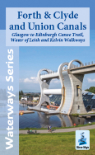
AREA COVERED - Side 1 - Thames Head to Wallingford, plus the route of the Thames & Severn Canal from Sapperton Tunnel to Inglesham. Side 2 - Wallingford to Thames Barrier.
CONTENT - Brief history and places of interest, colour pictures, boat yards and facilities, hire bases, maximum craft dimensions, headways of bridges. Enlarged maps of Lechlade-on-Thames, Oxford, Abingdon, Wallingford, Henley-on-Thames, Caversham and Reading, Windsor and Eton, Marlow & Kingston upon Thames.
DETAILS - Scale 1:55,000 (approx 1.8cms to 1km or 1.1" to 1 mile) and 1:12,500 for town plans. Size 14cms x 22.1 folded, 112cms x 44cms when opened out. 3rd edition 2019.