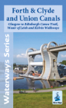
AREA COVERED - A tourist map of the Trent and Mersey Canal and River Trent with the Fossdyke Navigation at 1:50,000, with detailed town plans of Rugeley, Burton upon Trent, Willington, Nottingham, Newark-on-Trent and Lincoln at 1:12,500.
CONTENT - Includes navigation and historical information, visitor moorings, marinas and boatyards, boat hire centres, facilities for the boat user, shops and distance markers. Information for the tourist includes tourist information centres, places of interest, pubs, nature reserves, parks, churches, long distance paths, public toilets and caravan and camp sites.
DETAILS - Size 14cms x 22cms folded, 44cms x 126cms when opened out. 1st edition, 2022.