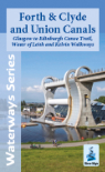
AREA COVERED - Side 1 - Llangollen Canal (Horseshoe Falls to Hurleston Junction), Montgomery Canal (Frankton Junction to Maesbury), Shropshire Union Canal (Barbridge Junction to Hack Green). Side 2 - Montgomery Canal (Newtown to Frankton Junction), Llangollen Canal (St Martin's Moor to Colemere).
CONTENT - Brief history and places of interest, colour pictures, boat yards and facilities, hire bases, maximum recommended craft dimensions. Enlarged maps of Llangollen, Ellesmere, Whitchurch, Newtown & Welshpool. Details of the Shropshire Union Canal Society.
DETAILS - Scale 1:56,000 (approx 1.8cms to 1km or 1.1" to 1 mile) and 1:12,500 for town plans. Size 13.6cms x 22.1cms folded, 95cms x 44.2cms when opened out. 3rd edition, 2020.